Tilbury lets you do almost anything you like to your house, and the trouble mostly starts once you step outside it. The town has a handful of listed buildings. It has no conservation area. Recorded crime runs about four in ten above the Thurrock average, and parked cars take more than their share of it. Middling overall, and lopsided with it.
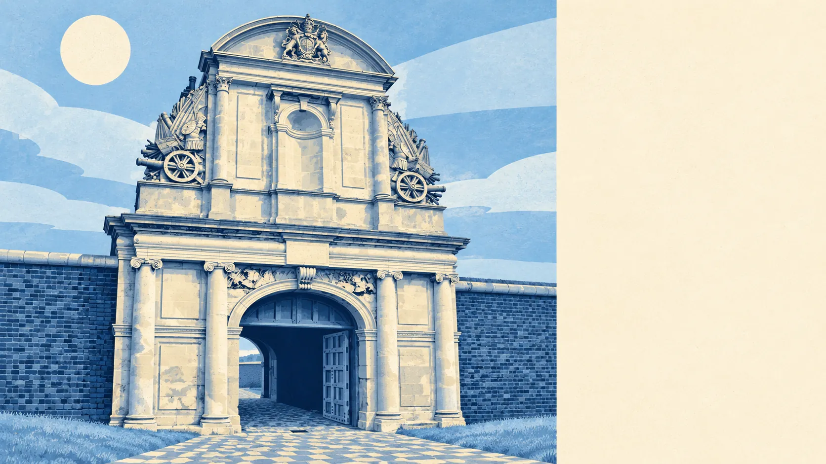
Historic England lists four buildings in Tilbury, two at Grade II* and two at Grade II, with none at Grade I, and the town has no conservation area of its own. For anyone planning a loft conversion or a rear extension, that means ordinary planning without the extra layer a listing or a designated area brings. The weight of history is concentrated on the riverbank. Henry VIII built a blockhouse there in 1539, it became Tilbury Fort, now the town's one scheduled monument, and English Heritage looks after it. The rest of the town went up for dock workers in the late nineteenth century, and the first tenements were built so badly that Tilbury stayed in a poor state until government money arrived in 1918. Nobody is going to defend that legacy against your dormer window.
On police.uk's recorded crime for the year to May 2026, Tilbury's rate is about 146 crimes per 1,000 residents, roughly 43% above the Thurrock average of about 102. The mix tells you where it comes from. Criminal damage and arson make up about 13% of recorded crime here against 7% across England and Wales, and vehicle crime about 11% against 5%. Violence and sexual offences land almost exactly on the national share, and shoplifting comes in below it. Across the whole Essex Police area, about 11% of crimes ended in a charge over the same twelve months, a little under the national 12%. A driveway earns its keep in Tilbury.
About 40% of households own their home, with social renting at 38% and private renting at 22%. The median resident is 33. Gross household income across the area, modelled by the Office for National Statistics for the financial year to March 2023, averages about £50,000. Tilbury was built round a port, and the port is still the reason it exists. Your landlord here is more likely to be a social one than a buy-to-let investor with a portfolio spreadsheet.
The flood picture depends heavily on which measure you read. On the Environment Agency's mapping, about 93% of Tilbury's postcodes fall in the high-probability river-and-sea flood zone, Flood Zone 3, and every postcode is inside the zone drawn for climate change. A broader measure, the share of postcodes on at least one flood indicator including surface water, puts about 88% at high risk. Those zones show where water would go with no defences in place. The Environment Agency's property-level assessment of risk from rivers and the sea, which does allow for defences, rates no homes at high risk, six at medium and 117 at low. The most recent recorded flood came from the sea in February 1953. The whole town lives behind a wall and trusts it daily.
Tilbury Town Rail Station is the local stop, with Grays and East Tilbury close by. At the 2021 census about 52% of working residents drove to work, 9% took the train and 14% worked from home. The area has 50 bus stops, and the 38 with timetable data average about 46 weekday departures each, all with a weekend service. Gigabit broadband reaches about 92% of premises. The Department for Transport's modelled journey times, which date from 2019, put the town centre about 25 minutes away by public transport and 15 by car, and the nearest hospital about 58 minutes by public transport against 24 by car. Gravesend is in plain view across the river, and since the passenger ferry stopped on 31 March 2024 it is reached by road the long way round.
The Land Registry recorded 66 sales in the year to mid-May 2026, at a median of £325,000. Terraced houses, the bulk of what changed hands with 39 sales, went for a median of £325,000, the 14 semis for about £377,500 and the ten flats for about £202,000. Band B is the most common council tax band, and about 68% of homes sit in Band A or B. Renting is priced on the borough. Typical private rent in April 2026 was about £1,360 a month for Thurrock as a whole, an Office for National Statistics average that was up about 6% on a year earlier.
The council tax valuation list, which covers every home, shows a town of terraces. About 52% of dwellings are terraced, 28% flats, 17% semi-detached and about 1% detached, with about 29% built before 1930. Energy certificates put about 47% of rated homes at band C or better, 44% at D and about 9% at E or worse. About 68% of homes heat with mains gas, and about 19% rely on electricity alone, a running cost that is far easier to absorb in a modern flat than in an older terrace. A detached house in Tilbury is more of a sighting than a search filter.
Green space is close for almost everyone, at an average of about 164 metres from home, and water is about 257 metres away on average, though most of that water is the Thames and most of what moves on it is cargo. West Tilbury, up on the ridge to the north-east and covered by this page, has its own conservation area and a church looking down over the marshes. The views go uphill in more ways than one.
Tilbury works for a buyer who wants a terrace at a price Thurrock still allows, plans to knock through or build out, and has somewhere off the street to leave the car. Anyone who needs to feel relaxed about a car parked outside overnight, or wants a hospital closer than an hour by bus, should look further along the line.
On balance Tilbury lands in the middle, generous to anyone with an extension in mind and harder going once the conversation turns to crime. Take it if the house matters more to you than the street it stands on.